Blues Creek Ravine Preserve
Accessibility Information
Parking Lot Description
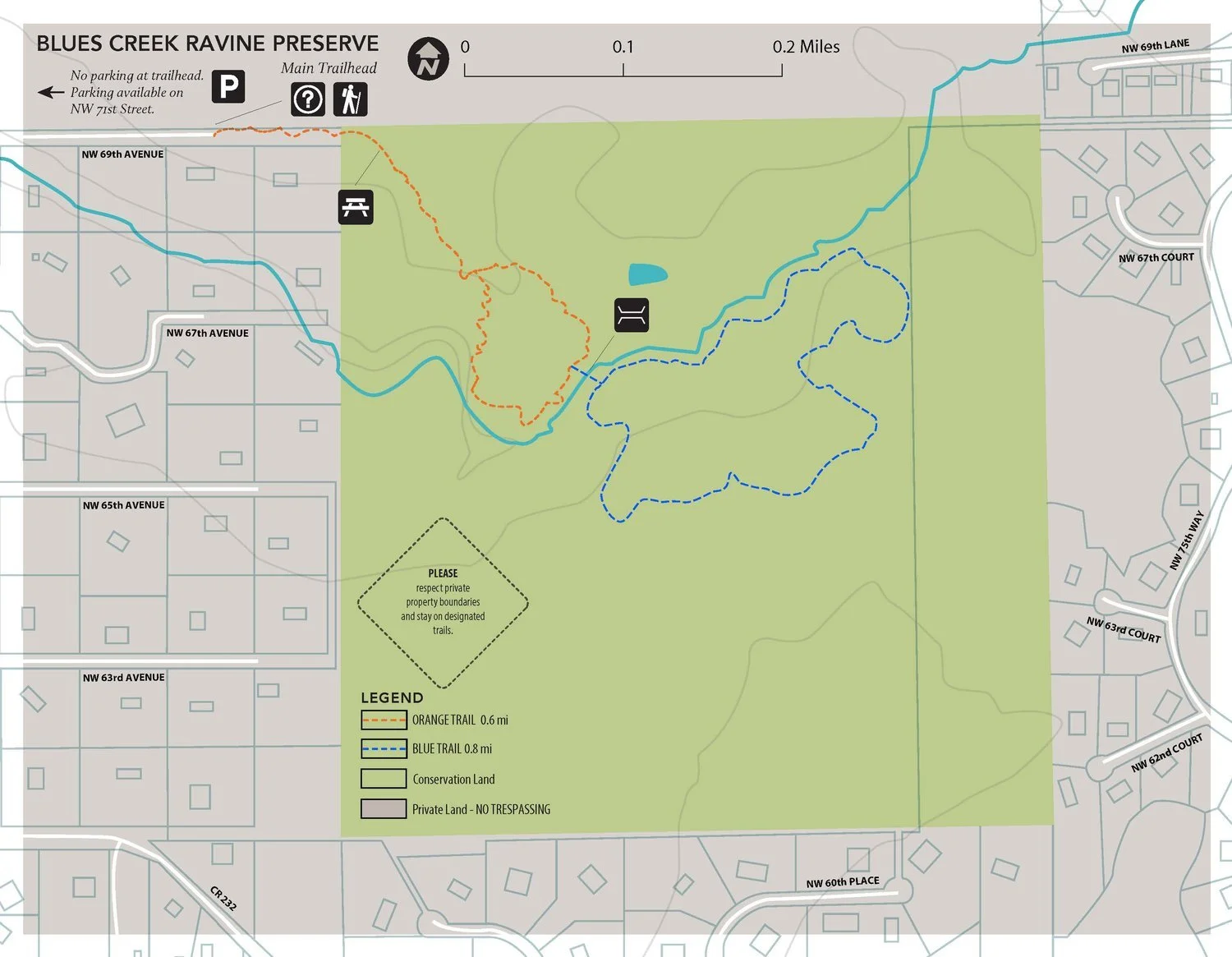
There is no public parking at the trailhead to Blues Creek Ravine. Parking is allowed along the shoulder of NW 71st Street and trail users can walk down a private dirt road to get to the trailhead. The dirt road is approximately 0.2 miles.
The trailhead contains an informational kiosk with printed maps and bike racks. There are no restrooms, water, trash cans, or seating.
Orange Trail
Trail Length: 0.6 miles
Steepest slope: 3%
Total elevation gain: 35 feet
The trail system begins on the Orange trail. The trail hugs a fence line for 0.1 miles before turning into the forest. Visitors are treated to a beautiful upland hardwood forest with numerous hardwood trees such as Swamp Chestnut Oak, American Hornbeam, Winged Elm, Live Oak, and Southern Magnolia. The trail surface is soil and leaves with some root protrusions. There is a picnic table (non-accessible) along the trail 0.2 miles into the trail. Shortly after, trail users come to a fork where they can pick to go left or right on a loop. If veering left, the trail hugs several sink holes and eventually comes to Blues Creek where trail users get an amazing view of the ravine and the creek that formed it. At 0.4 miles there is a side trail to a bridge across the creek to the Blue trail. Continuing on the Orange loop past the bridge will bring users to another side trail the leads to a bench along the creek. Trail users are treated to 4 educational signs along this trail.
Blue Trail
Trail Length: 0.8 miles
Steepest slope: 4%
Total elevation gain: 61 feet
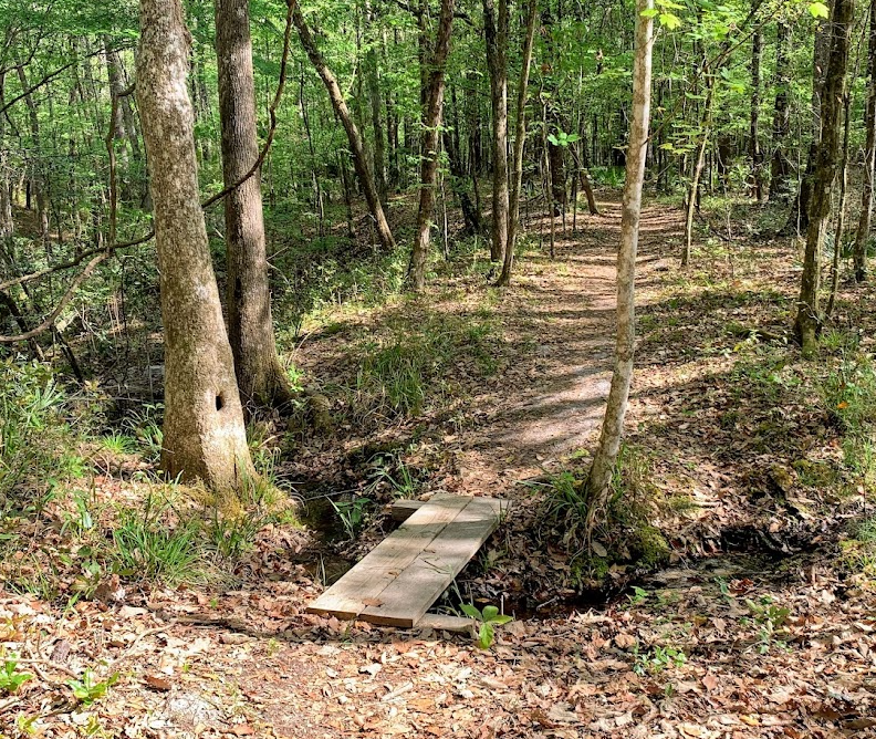
The Blue Trail begins as a side trail off the Orange Trail loop. Users have to traverse a steep (5%) descent towards the bridge. The trail is fairly narrow and contains several large roots. The bridge is a 16-foot long, 4-foot wide wooden bridge with a railing on one side and a step to get up. After the bridge is a switchback that takes trail users up the the loop portion of the blue trail. The trail surface is soil and leaves and contains very few root protrusions. If veering left, the trail takes users along the ridge of the ravine for a while, crossing a small creek over a 5-foot long, 2-foot wide wooden footbridge. The trail cuts between several sinkholes and contains 2 education signs.
Contact ACT for more information or comments about our accessibility of our preserves by calling (352)373-1078 or emailing info@alachuaconservationtrust.org


