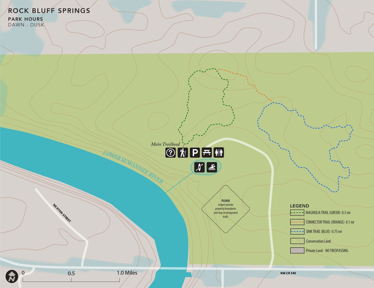
Rock Bluff Springs at J.H. Anderson, Jr. Memorial Park
Accessibility Information
Parking Lot Description
Rock Bluff Springs Park has an entrance fee at the entrance of the park. After paying, the trailhead and parking area is 0.25 miles down the dirt access road. The trailhead and parking area is at the end of the road primarily dirt and leaf litter. The trailhead contains an informational kiosk with printed maps, picnic tables, trash cans, and a port-a-potty. There is no running water or drinking water.
Magnolia Trail (Green)
Trail Length: 0.5 miles
Steepest slope: 1%
Total elevation gain: 10 feet
The Magnolia Trail is a loop trail with trail surface primarily made up of soil and leaf litter. There are protruding roots in some areas of the trail. The trail passes through a lovely upland hardwood forest with trees such as Pignut hickory, Swamp chestnut oak, and Southern Magnolia. 0.25 miles into the trail users come to a junction where a connector trail (Orange) can be taken to the Sink Trail. In the future, this trail will have education signs.
Connector Trail (Orange)
Trail Length: 0.1 miles
Steepest slope: 1%
Total elevation gain: 4 feet
This short connector trail connects the Magnolia and Sink trails. Its trail surface is primarily soil with some protruding roots.
Sink Trail (Blue)
Trail Length: 0.75 miles
Steepest slope: 2%
Total elevation gain: 17 feet
The Sink Trail loops visitors through upland hardwood forest and bottomland forest with views of several sinkholes. The trail surface is soil and leaf litter with some protruding roots. In the future, there will be education signs on this trail.
Contact ACT for more information or comments about our accessibility of our preserves by calling (352)373-1078 or emailing info@alachuaconservationtrust.org


